 Geobru catalogue
Land Cover Grid Coverage
Type of resources
Available actions
Topics
INSPIRE themes
Keywords
Contact for the resource
Provided by
Years
Formats
Representation types
Update frequencies
status
Scale
Resolution
-
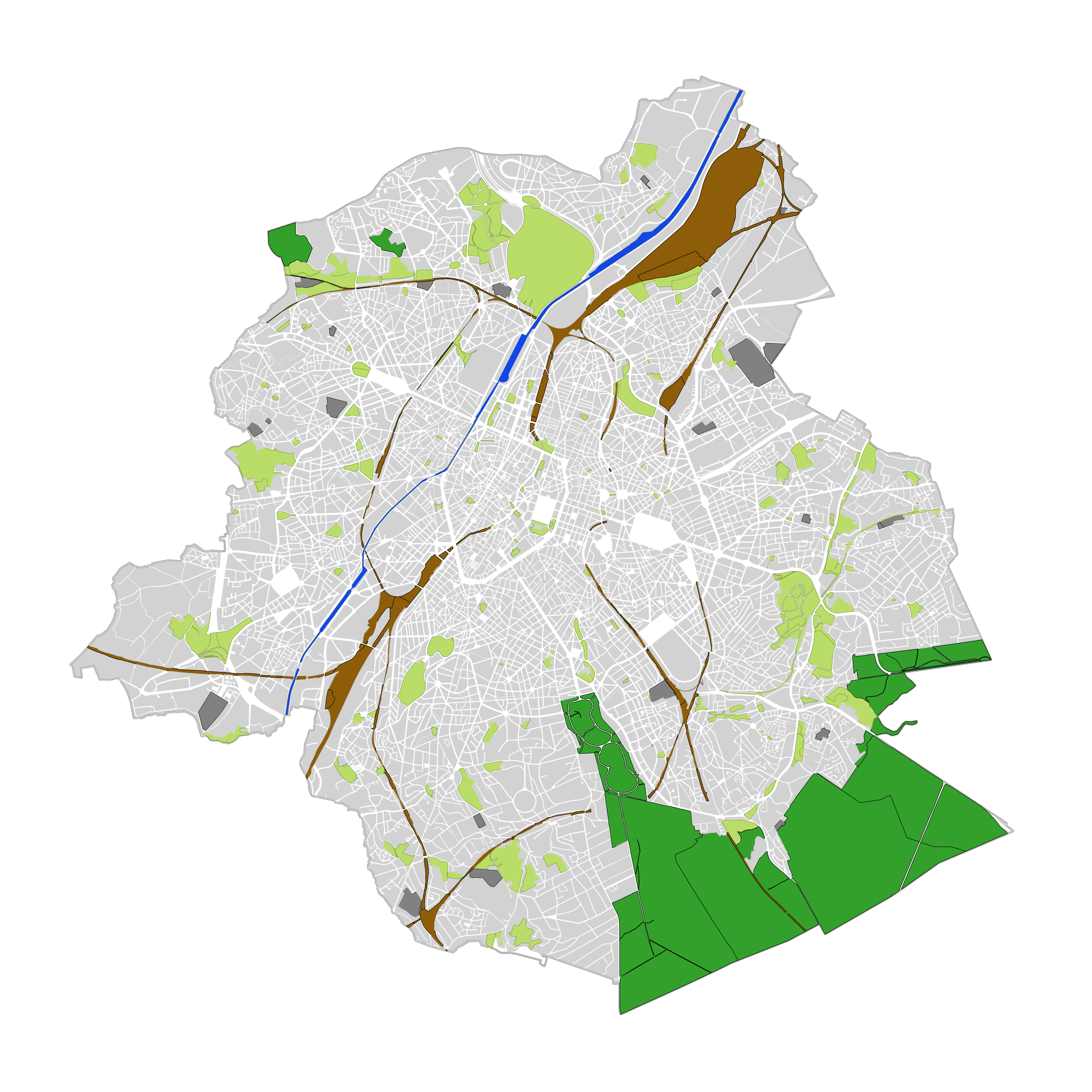
Brussels-Capital Region : land cover refers to the physical and biological cover of the earth's surface, including artificial surfaces, agricultural areas, forests, semi-natural areas, wetlands, water bodies. The entity "Green Block" (or green area) identifies the footprint of vegetated amenity areas(lawn, trees, possibly planted with flowers and ornamental trees and bushes, and often lined ponds and paths). Green areas have been designed on the basis of various plans (photogrammetric surveys, detailed maps, maps of towns, ...). They have a heterogeneous precision because of the diversity of origin. The entity "Green Block" (or green area) is represented using three different types: - GB-A: grassed (some grassy berm plants or trees) bands; - GB-B: parks (water parks located in these areas are not excluded); - GB-F: forests or wood (islets of the Soignes Forest located in the Brussels Region). The entity "Water Block" (or water area) locates and identifies various water bodies in the territory of the Brussels-Capital Region (channel, ponds, Senne river, ...). We distinguish : 1. water areas located at [0] which are visible from the air (abbreviated WB-0); 2. water areas (for the channel) located at [-] on the road (invisible from the sky) (abbreviated WB-M).
-
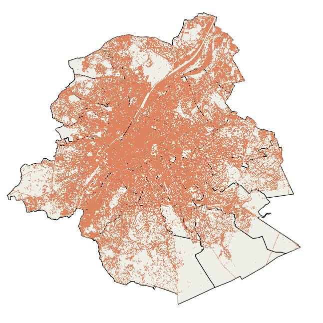
This map indicates the impervious surfaces where rainwater cannot or hardly infiltrate into the soil for the year 2022. Impervious surfaces are: artificial sealed surfaces (such as streets, squares, car parks ...), buildings and compact soils. Permeable surfaces are vegetation-covered soils, bare soils and water areas. Railway areas are permeable or impermeable depending on the type of cover. The map was compiled from satellite images (Sentinel -2) and orthophotos (from UrbIS and Digitaal Vlaanderen) with a final resolution of 1m.